


3eme Rando Innsbruck

patign
User
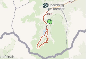

Length
10.1 km

Max alt
1899 m

Uphill gradient
338 m
Km-Effort
15.3 km

Min alt
1404 m

Downhill gradient
529 m
Boucle
No
Creation date :
2025-05-15 08:45:22.0
Updated on :
2025-05-15 13:07:39.264
2h43
Difficulty : Medium

FREE GPS app for hiking
 SityTrail
IGN / Geographical institutes
SityTrail Plus
The world is yours!
About
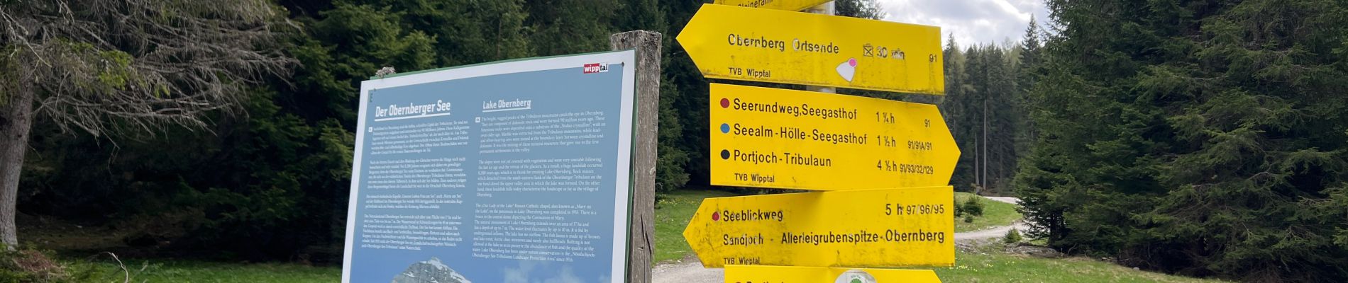
Trail Walking of 10.1 km to be discovered at Tyrol, Bezirk Innsbruck-Land, Gemeinde Obernberg am Brenner. This trail is proposed by patign.
Photos


Positioning
Country:
Austria
Region :
Tyrol
Department/Province :
Bezirk Innsbruck-Land
Municipality :
Gemeinde Obernberg am Brenner
Location:
Unknown
Start:(Dec)
Start:(UTM)
682899 ; 5207559 (32T) N.
Comments